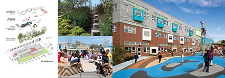
At Dodson & Flinker, we strive to design meaningful places where people can form new connections with nature, community, history and culture. With over 35 years of practice, our landscape architecture experience includes designing waterfronts, schools, municipal facilities, parks and greenways, trails, and streetscapes. We are also an industry leader in regional and municipal planning, with particular expertise in natural and cultural resource planning, Smart Growth, and designing and facilitating public engagement processes—including design charrettes and workshops. Our planners and landscape architects care about context, including site history, ecology, and broader settlement patterns. We are committed to sustainability and resilience, and prefer landscape interventions that are cost effective, strengthen community, foster biodiversity, protect existing farms and habitat areas, and work to limit fossil fuel consumption.
